
September 11, 2026 Hail Storm in Converse, TX
A severe thunderstorm moved through Kirby, Converse, and China Grove the night of September 11, 2026 — a Tornado Warning, baseball-size hail (2.5") reported in Converse, golf ball-size hail (1.75") in additional reports, and wind gusts to 60 mph. Swath modeling (GAF / PSAI) shows hail up to 2.75" somewhere in the storm path. Here's what has been reported, by source, and what to do next.

- September 14, 2026 Added newly available Local Storm Reports, including a 2.5" baseball-size hail report in Converse — now the largest reported reading for this storm. Added photos from Atrium's own post-storm inspections across three Converse properties.
- September 13, 2026 Added local news coverage confirming hail reports in Converse. As of this date, NWS has not published a damage survey confirming a tornado touchdown in this corridor.
Not sure whether hail reached your roof?
A free, engineer-led 53-point inspection documents what is actually there, with dated photos and a written report, so you can decide what to do next with facts. If there is no damage, we will tell you that too.
Get My Free Roof InspectionThe September 11, 2026 storm, report by report
Each line below is what the National Weather Service or a confirmed spotter actually reported. Nothing here is an estimate of damage — damage is established by looking at a specific roof, not by a radar signature.
- 9:59 PM CDT2.5" · Baseball sizeConverse (3 SE)Source: Local Storm Report — numerous social media photos of 2–2.5" hail in Converse, including photos showing damage to vehicle windshields and windows.
- 10:04 PM CDT0.75" · Penny sizeGusts to 55 mphKirby / near ConverseSource: NWS Austin/San Antonio special weather statement — Doppler radar tracked a strong thunderstorm over Kirby, near Converse, with wind gusts of 50–55 mph.
- 10:04 PM CDTGusts to 60 mphSchertz (2 S) / Randolph AFBSource: AWOS station KRND, Randolph AFB — measured 60 mph gust (instrument reading, not radar-estimated).
- 10:10 PM CDT1.75" · Golf ball sizeConverse / Paloma Subdivision (4 SSE)Source: Local Storm Report — dime to golf-ball size hail reported via social media in the Paloma Subdivision, Converse.
- 10:12 PM CDT1.75" · Golf ball sizeGusts to 60 mphKirby / near ConverseSource: NWS Austin/San Antonio severe thunderstorm warning (in effect until 11:15 PM CDT) — storm located over Kirby, near Converse, moving southwest at about 15 mph.
- 10:17 PM CDT1" · Quarter sizeSaint Hedwig (2 NE)Source: Local Storm Report — 1" diameter hail near Saint Hedwig.
- 10:18 PM CDT1.5" · Ping pong ball sizeKirby (3 ENE)Source: Local Storm Report — trained spotter reports 1 to 1.5" diameter hail.
- 10:25 PM CDT1" · Quarter sizeGusts to 60 mphNear China GroveSource: NWS Austin/San Antonio severe thunderstorm warning — storm near China Grove, 7 miles northeast of Stinson Municipal Airport, moving southwest at about 15 mph.
- Night of 09/11/20261.75" · Golf ball sizeNear Converse (ground report)Source: Confirmed spotter report dated 09/11/2026 — 1.75" golf ball hail near Converse.
A Tornado Warning was issued for the storm cell tracking from Terrell Hills through Converse toward Schertz, Universal City, and Randolph AFB, based on radar-indicated rotation. The warning was renewed until 10:30 PM CDT as the cell continued toward Cibolo and Zuehl. As of publication, NWS has not confirmed a tornado touchdown in this corridor — that requires a ground survey, which is separate from the warning itself.
A Flash Flood Warning was issued for Central Bexar County. 1–2 inches of rain had fallen by 10:02 PM CDT, with up to 1 additional inch possible.
Where the reports came from
Markers are the individual reports listed above. Click one for its time, size, and source.
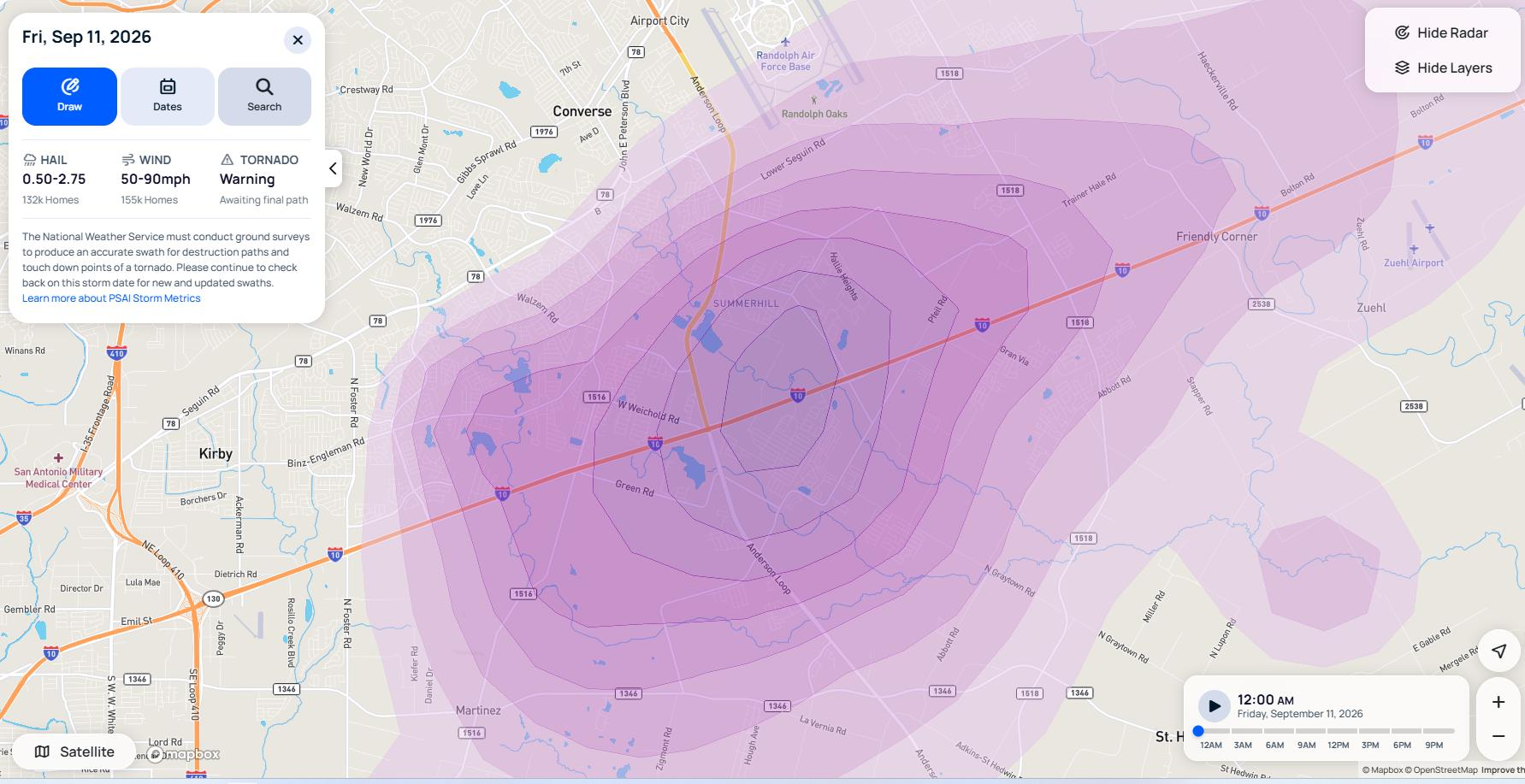
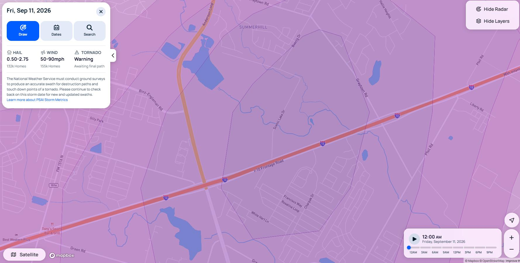
Modeled swath data, separate from the point-specific NWS and spotter reports above. Source: GAF / PSAI Storm Metrics storm swath analysis.
- KSAT 12·September 12, 2026
KSAT's weather team collected viewer-submitted photos and videos of hail in Converse from the night of September 11, including one timestamped around 10:06 PM near FM 1516 in Converse.
Read the coverage
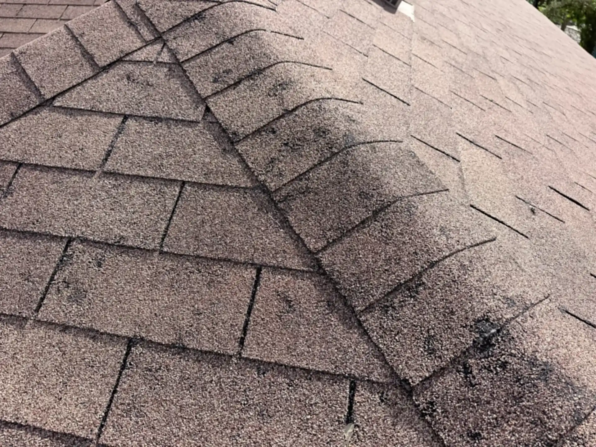
Photographed during Atrium's own post-storm inspections in Converse, TX — shared with homeowner permission.
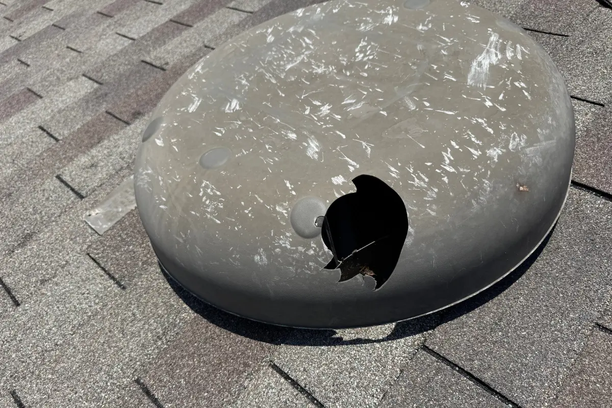
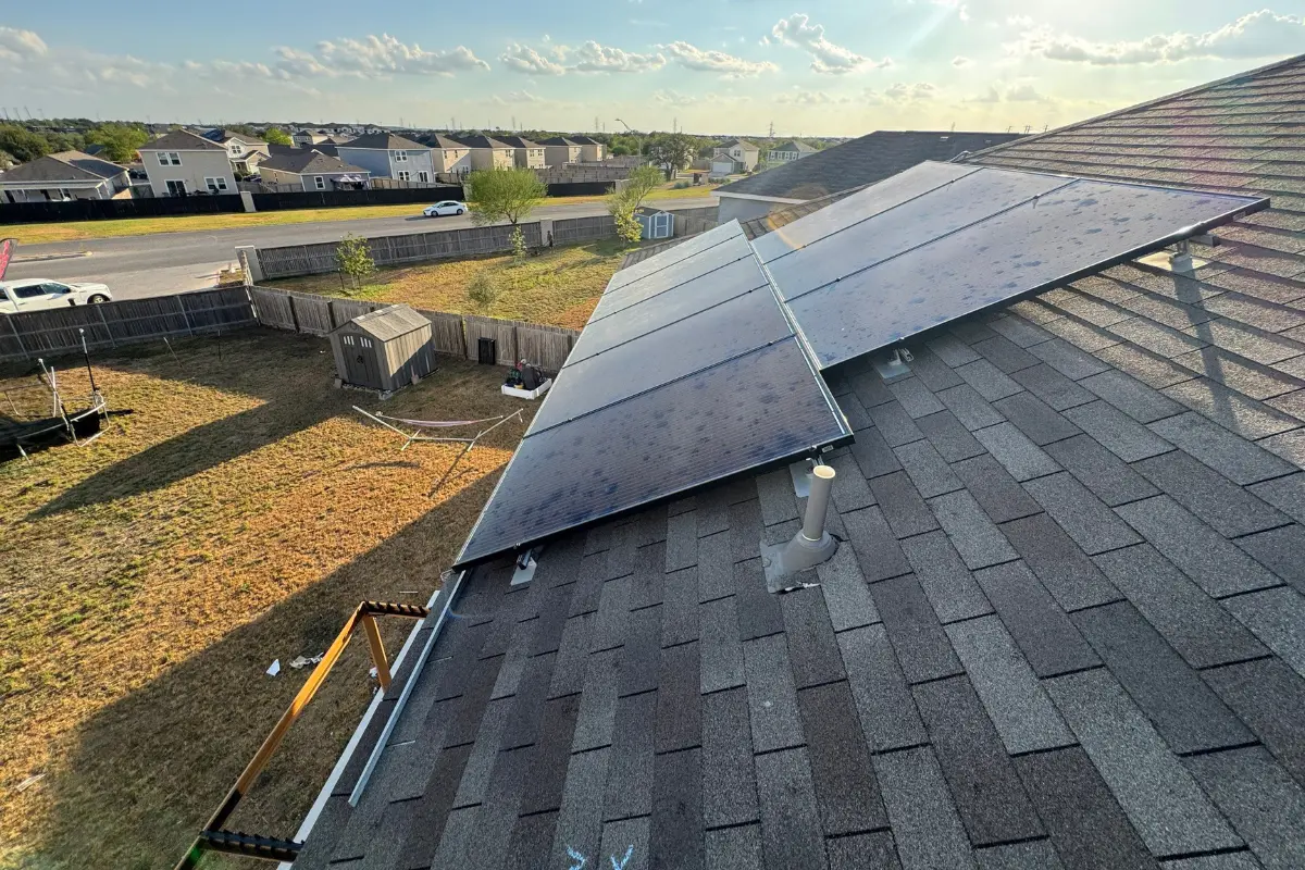
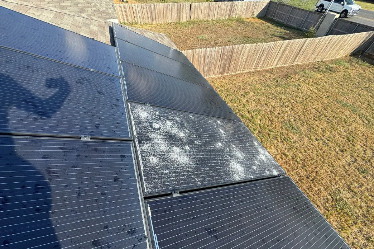
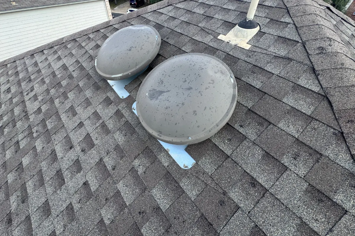
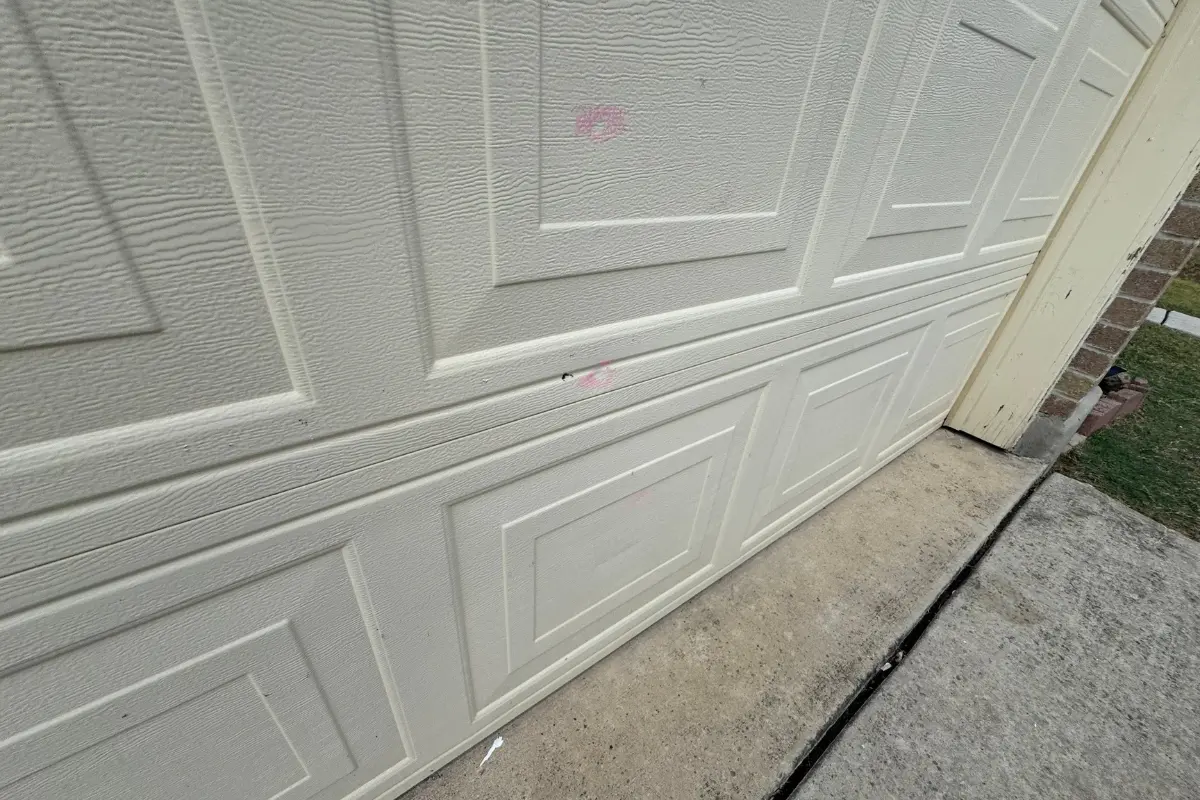
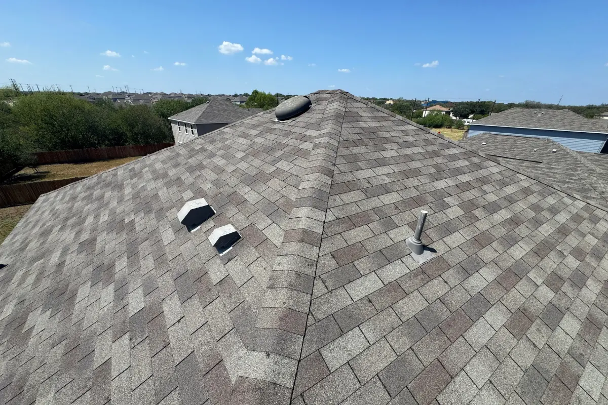
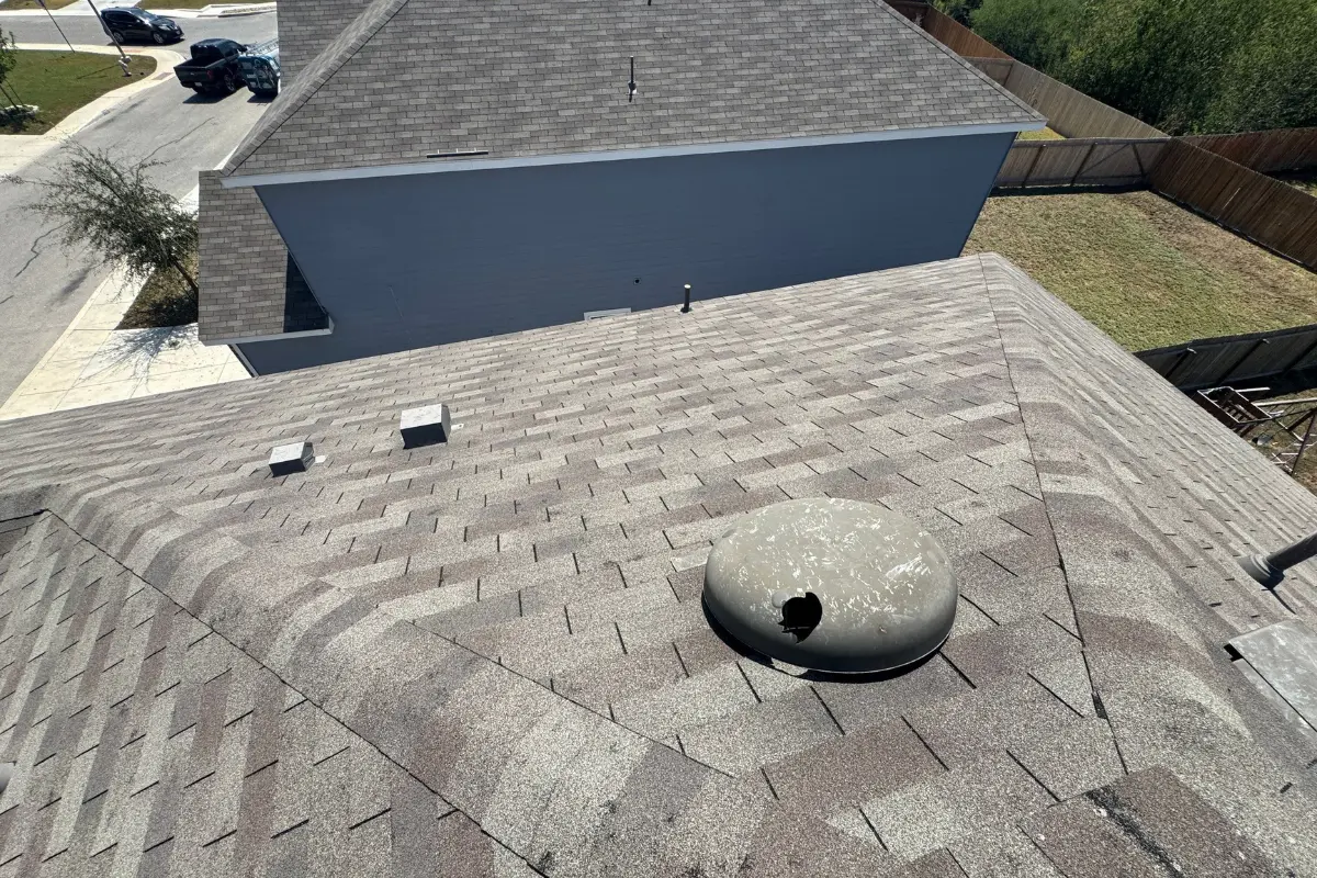
A warning polygon is a broad area, and hail inside one is never uniform. Being listed here means an inspection is worth doing — it is not, on its own, evidence that your roof was damaged.
What homeowners actually say
Published, verifiable reviews from third-party platforms, not marketing copy.
The first steps that actually matter
Photograph what you can see from the ground today: dented gutters and downspouts, bent window screens, flattened AC condenser fins, and granules collected where downspouts drain. Note the date on the photos. Do not climb on the roof, and do not sign anything with someone who knocked on your door the morning after a storm.
Then get the roof documented against this storm date. Hail fractures the asphalt mat below the surface, so a roof can be functionally damaged for a year or more before a ceiling stain appears — which is precisely why the record you create now is worth more than the one you create after the leak.
Our guide to hail damage documentation shows what a proper record includes. When you're ready, book a free inspection, or read more about your Converse roofing company.
Depending on what the inspection finds, the next step is either a targeted roof repair or a full roof replacement. If you do replace, ask about Class 4 impact-resistant roofing systems, which is what we recommend asking about in a hail corridor. And before any contractor offers to cover your deductible, read the Texas deductible law: waiving it is an offense.
After a storm, if a contractor offers to cover your deductible or you suspect a padded claim, you can report it to the Texas Department of Insurance. How to report insurance fraud.
On the claim side, Texas policies carry a reporting deadline, and the practical constraint is proof rather than the calendar: the longer you wait, the harder it is to tie damage to this storm instead of an earlier one. Our insurance guide covers deductibles and depreciation, and how roof insurance claims work walks the full sequence step by step. We don't restate it here — we just document the roof and tell you which path you're actually on.
Prefer to choose your own time? Pick a slot below.
Choose a day and time for your free inspection. The calendar opens from our scheduling provider when you tap, so nothing third-party loads or sets cookies until you ask to book.
If the calendar does not appear, open it directly at our booking page, or call us and we will schedule it for you.
Converse homeowner questions about this storm
Let's take a look at your roof in Converse.
No pressure, no obligation. Calls answered 24/7 in English & español by Alex, our AI specialist · Get an engineer-led 53-point roof inspection, not a sales pitch.